


By: Peter Kollie |Lofa Correspondent
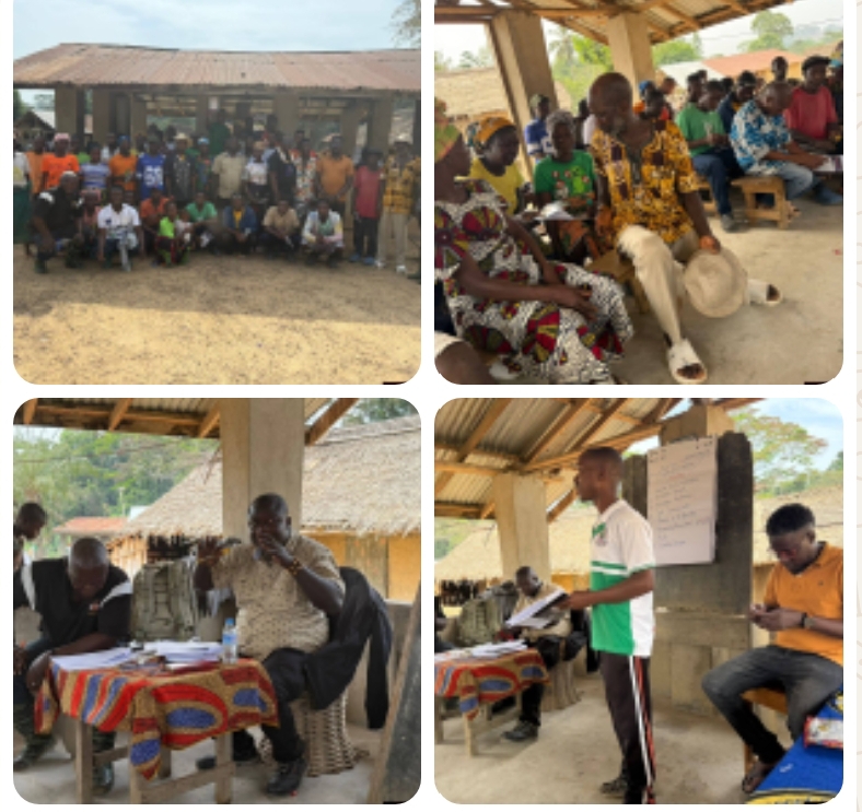
Lofa County, Liberia |Feb. 11, 2026|The Sustainable Development Institute (SDI), in collaboration with the Liberia Land Authority (LLA), has successfully prepared Zone Four communities in Bluyema Clan, Zorzor District, Lofa County, for a confirmatory land survey under Liberia’s Customary Land Formalization program.
The exercise followed a comprehensive validation process involving the communities of Lobobah, Soblima, and Wanlima. The process brought together more than 50 participants, including women and youth leaders, members of the community assembly, the Community Land Development and Management Committee (CLDMC), traditional chiefs, and other key stakeholders.
Facilitated by the Liberia Land Authority, the validation focused on assessing community compliance with the three core stages of customary land formalization: community self-identification, governance formation through by-laws and establishment of CLDMCs, and boundary negotiation and harmonization.
Participants actively engaged in responding to assessment questions designed to verify their readiness for formal land registration.
Upon completion of the exercise, the communities now await an official report, which is expected to qualify them for a confirmatory survey — a critical step towards securing statutory land deeds.
Several positive outcomes were recorded during the validation process, including the signing of boundary harmonization memoranda with neighboring communities. The only outstanding boundary issue remains the county border with Gbarpolu County.
The process follows the successful completion of community self-identification, by-law adoption, and formation of CLDMCs. With technical support from SDI, local boundary harmonization teams resolved long-standing land disputes, some dating back more than 20 years.
Observers noted that the CLDMCs are increasingly being recognized by traditional leaders and local authorities as central institutions for land governance and natural resource management.
To finalize the boundary harmonization process, the CLDMCs and boundary teams have been mandated to engage traditional leaders in neighboring Gbarpolu County to sign a memorandum of understanding on farming land usage. This step is expected to eliminate remaining disputes and pave the way for confirmatory surveys and eventual issuance of statutory deeds.
The initiative also featured extensive public awareness campaigns at town and sub-community levels, along with radio outreach programs.
These activities were coordinated by the LLA’s Lofa County office, with technical support from its national headquarters, between February 1 and 7, 2026.
The project is being supported by the Forest Fund (FF) as part of a broader effort to advance customary land formalization and gazettement in Zone Four.
Zone Four communities are located within the Wologizi Proposed Protected Area, spanning parts of Zorzor and Voinjama districts. The formalization process is therefore expected to play a vital role in balancing community land rights with environmental conservation.
Stakeholders believe the successful completion of the confirmatory survey will strengthen land security, reduce conflicts, and promote sustainable land and natural resource management in the region.
